
|
|
| Home | What's On | AGM 2007 | Oxford Map |
| BookCrossing | First Class | November Walk | Contact |
Getting to the AGM and Pub Meets
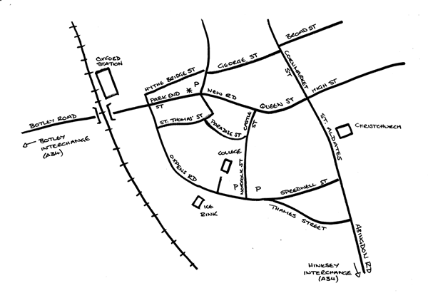
The map shows most of the major roads in the south-western part of Oxford city centre and some of the smaller roads where relevant. The college is marked (on Oxpens Road), and Rosie O’Grady’s (on Park End Street) is indicated with an asterisk.
It also shows the direction of the Botley and Hinksey interchanges on the A34. Both the Botley Road and the Abingdon Road can be slow from the A34 to the city centre.
There is adequate (free) car parking at the college, and a surface pay and display immediately next to it.